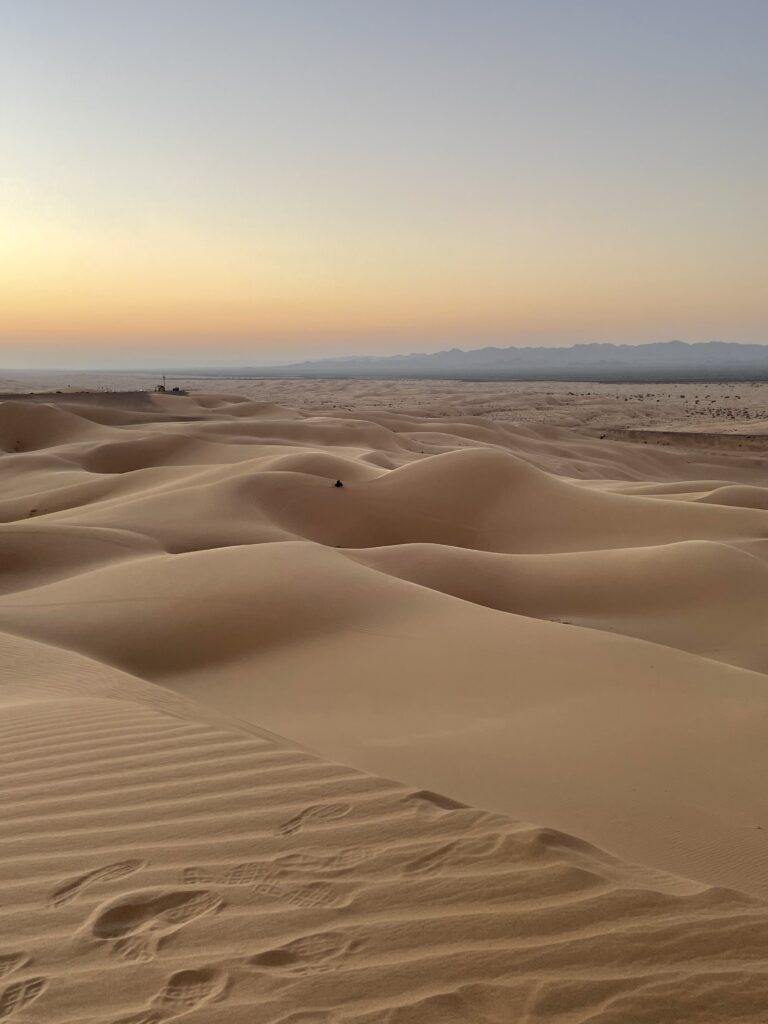
The Imperial Sand Dunes or Glamis Sand dunes as we call it is actually part of the Algondones Dunes. The dunes are nestled between the chocolate and Black mountains to the East and farm land to the west. Located in the southeastern part of California (Imperial County) up against the US Mexico border. The sand dunes originate in Mexico and travel roughly 45 miles north with a max width of roughly 6 miles in some areas. The Dunes were created by the wind blown off the shores of what was once called lake Cahuilla that disappeared in the early 1500s. We know the area now as the Salton Sea (created in the early 1900’s). The sand and dust traveled from the eastern shores and then collected in the area that is now considered Imperial Sand dunes. The sand dunes are Managed by Bureau of Land Management (BLM). So they fall under federal management and not the state of California. The Main riding area is roughly 27 miles east of the small town Brawley CA. The bigger cities close by would be El Centro, Calexico, Yuma, Blythe depending on which direction you are traveling. Glamis is dissected by Highway 8 in the south and Highway 78 to the north, which allows highway traffic to move east and west across the dunes.
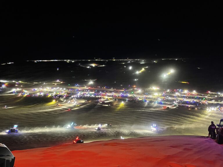
Glamis Dune season usually falls from Halloween Weekend to Easter weekend. Permits are required for parking from October 1 to April 15 each year. Best to plan to buy off site and they are cheaper. Many local motor cycle shops and some gas stations on the way in will sell them. The weather usually dictates visitors. The winter time allows a more pleasurable experience, even though it will get really cold on winter nights in January with temps down to the low 30’s and a high of 60. Summer time temp will range into the 115 range and will only cool to 100 at night, making it hard on equipment and you.
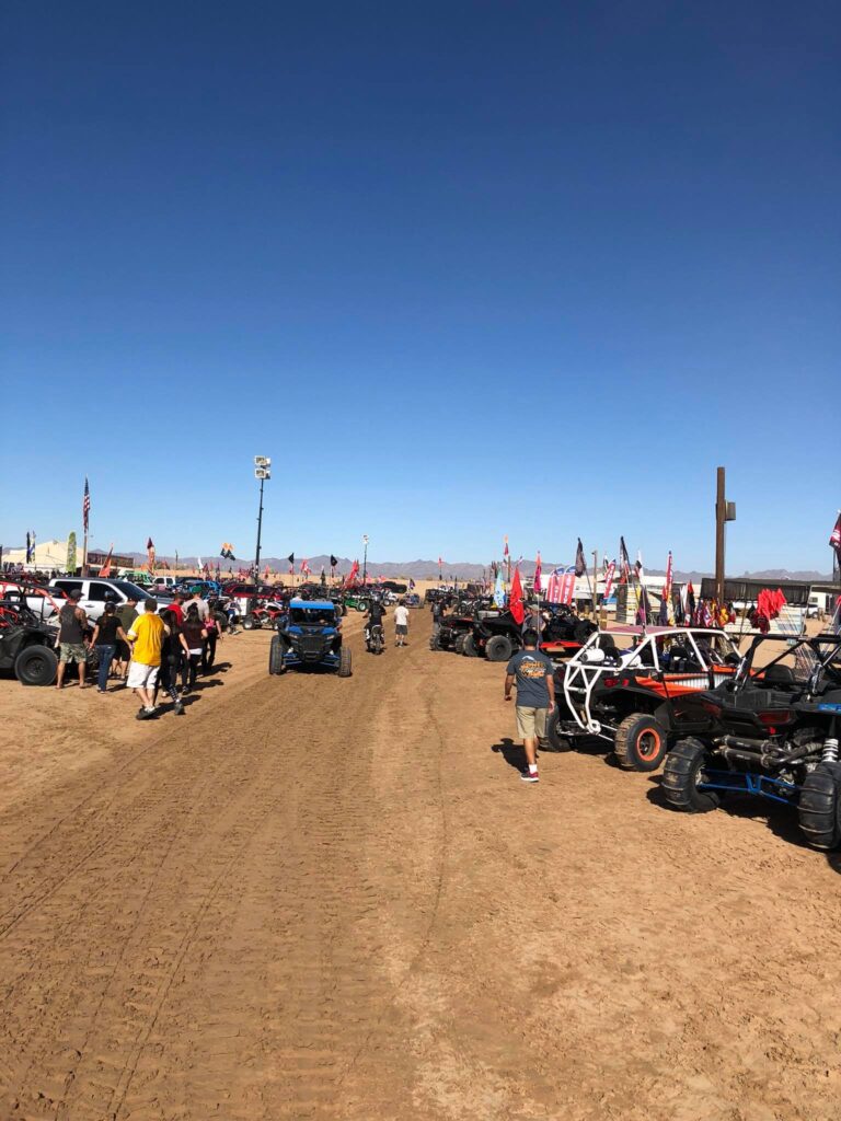
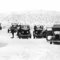
Glamis has been an off roading destination since the Car was invented. In the early 20s people were figuring out how to cross the dunes from San Diego to Phoenix along the southern route. Eventually a Plank road was created that will be covered in another post. In the 50’s and 60’s people started creating what we would consider the first dune buggies. A specialty vehicle that was developed specifically to conquer the sand dunes. The first versions were flat panned air cooled Volkswagen with there 36hp and “water pumpers”. VW’s were air cooled and required no coolant which help keep them light with their flat 4 cylinder motor. While water pumpers were usually higher horsepower and made with a V8 motor that had some kind of coolant with a radiator to dissipate heat. You may have seen old pictures of water pumpers that may have a roll bar along with 2 rear tires to help flotation in the sand. From those early vehicles it has now spawned a multi billion dollar industry that helps stimulate the economy.
Directions to Glamis
People travel thousands of miles across the country to travel here. For specific directions from your current location Click Here to our contact page and click on directions link in google maps. Here is general directions from closest major cities.
From Southern San Diego:
- Take Interstate 8 East toward El Centro.
- Continue on I-8 East for approximately 150 miles.
- Just pass El Centro head north on highway 111 23miles.
- Then head west on highway 78 just east of Brawley. (last chance for gas)
- Follow till you see Gecko Rd and the Ranger station you have arrived
From Temecula/Murrieta.
- You can travel north to 10 and follow directions from LA.
- If not travel south to CA-79 head east.
- Turn left on route S-2 San Felipe RD
- Turn left on HWY-78 towards Ocotillo wells
- Turn right on CA-86 towards Brawley
- Follow this road it will turn back into CA-78 follow till you see the dunes.
From Los Angeles:
- Take Interstate 10 East toward Indio.
- Merge onto CA-86 South via Exit 162 toward Brawley/El Centro.
- Continue on CA-86 South for approximately 100 miles.
- 86 and 78 Will merge around the border checkpoint.
- Continue on CA-78/86 east till you reach Brawley. Take the Bypass before unless you need to stop.
- You will need to make a left as 78 will transition to 115. You will know by the smell.
- continue on till you pass the canal and see Gecko rd and the Ranger Station.
From Phoenix:
- Take Interstate 10 West toward California.
- Merge onto CA-78 West via Exit 156 toward Blythe.
- Continue on CA-78 West for approximately 140 miles.
- After the Gold mine you will see the train tracks and the Beach Store. You have arrived
Familiar Names
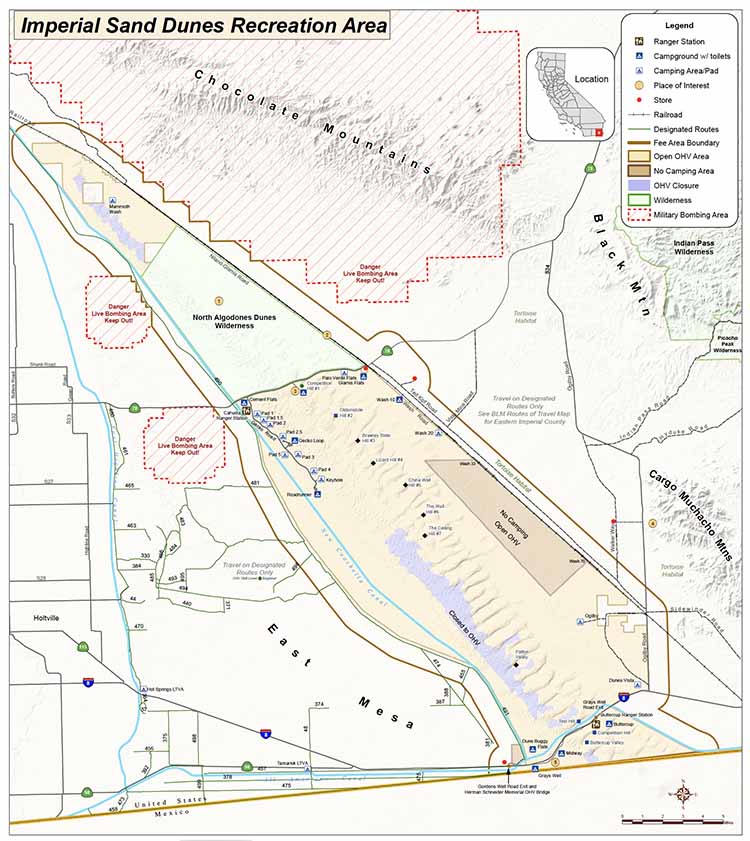
Imperial sand dunes is one large area that make up the 45 mile by 6 mile wide sand area but can be broken down to several smaller areas such as Glamis, Gordons Wells, Buttercup, or to the far north is Glamis Hot springs. It is possible for one to drive from the northern part of Glamis and travel the 20 plus miles south to the border traversing all 3 main riding areas. Heading north There is an access road on the east and west side of the northern closure area that allows you travel north to the hot springs but you cannot do so through the dunes as this area is off limits to vehicular traffic. One is free to park on the outskirts and then walk through these dunes.
- Glamis- refers to the area bordering highway 78 to the north and roughly 10 miles south
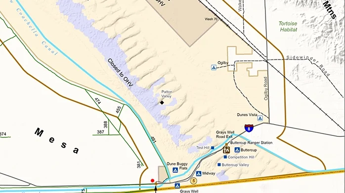
- Gordons wells- The area north of interstate 8 and roughly 10 miles north
- Buttercup- the area south of interstate 8 to the Border Wall
- North Glamis Hot springs- The very northern tip there is a small area open to the public.
- North Algodones closure- roughly 25,000 acres north of highway 78 closed to OHV.
- Train tracks and canal border on the East and the West respectively.
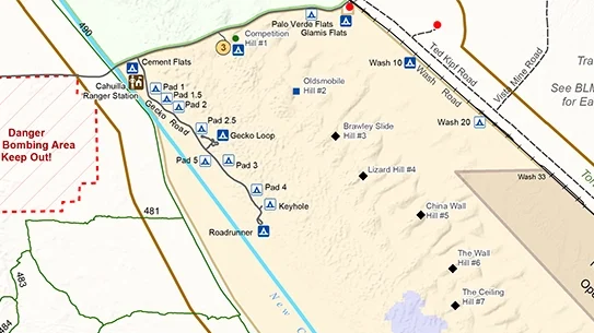
To Further describe each area is needed to understand the layout. Glamis has several land marks that you may have heard of that makes up the majority of destination spots in the dunes. They may include vendors/store, Gecko, The Washes/Flats, Osbourne Lookout, Cement Flats, Competition hill, Oldsmobile Hill (Olds), The Slide, China Wall, Flag Pole, Swing Set.
One can drive from the northern part of Glamis and travel the 20 plus miles south to the border traversing all 3 main riding areas. There is an access road on the east and west side of the northern closure area that allows you travel north to the hot springs but you cannot do so through the dunes as this area is off limits to vehicular traffic. one is free to walk through the dunes.
Many people usually stay in the area that they are camping or in close proximity. People may only camp at Glamis and never camp in Gordons well or Buttercup. Each area has a unique experience that may have you fall in love with over Glamis.

Glamis is Remote
To Visit Glamis you must understand that there is a limited supply of parts and food available to you. The best plan is bring everything you need, this would include food, gas, and extra parts. There are some porta- potty type bathrooms have been made available and trash dumpsters to use.
- Make sure to stop in town to stock up on food and Gas.
- Bring Plenty of Water and Gas, vendors will sell water but not gas.
- Bring the food for your stay, the closest grocery store is 30 minutes
- Have a Tow vehicle that is in good working order to get you there
- Make sure your vehicle is up to the task and you have parts to replace the most frequently broken items
Although there are many vendors located by the Beach store they will have basic necessities and parts. Many times between all the vendors you can find the parts Necessary to get you back in the dunes. Best plan is to purchase food, drinks, parts at home and pack them with you.
Biggest thing to remember is that this is a Pack it in Pack it out destination. Dumpster have been made available SO USE THEM! Do not leave Anything behind at camp, Trash in the dunes, please leave the place cleaner than when you arrived. If we cant keep Glamis clean then we will lose the ability to use the land.